If you have followed me for any length of time, you know that I am fascinated with maps. All kinds of maps.
As I sat down to write a story about a family memory, I soon realized that the story was not as easily told as I had assumed. Some details were not adding up, and as I cannot make a quick run up to Green Bay in Brown County, Wisconsin, to visit the Register of Deeds, I turned to online resources, and found a treasure published on BrownDog the Official GIS Map of Brown County Wisconsin site, via the Brown County, Wisconsin website. (This link is current as of 29 Dec 2025: https://www.arcgis.com/apps/webappviewer/index.html?id=61fba3fd419045e48aa6ba759838387c )
Here I found “Original Surveys (1830s – 1840s),” “Plat Book Maps from 1889,” “Plat Map from 1900,” “Air Photos Summer 1938,” and much more. While some of these maps are available elsewhere, I love nothing more than to find them all in one place. And here they have done the overlay work for you, you no longer have to download the maps and manually overlay them in Google Earth. Wonderful!
While the Town of Holland spans just under 40 square miles, my focus is on Section 34, and the Town of Holland, or Hollandtown, specifically the West 1/2 of Section 34, Township 21N, Range 19. Included here are the original surveys from the 1830s-1840s, and these maps remind us that Plum Creek has been documented running through Hollandtown for almost 200 years.
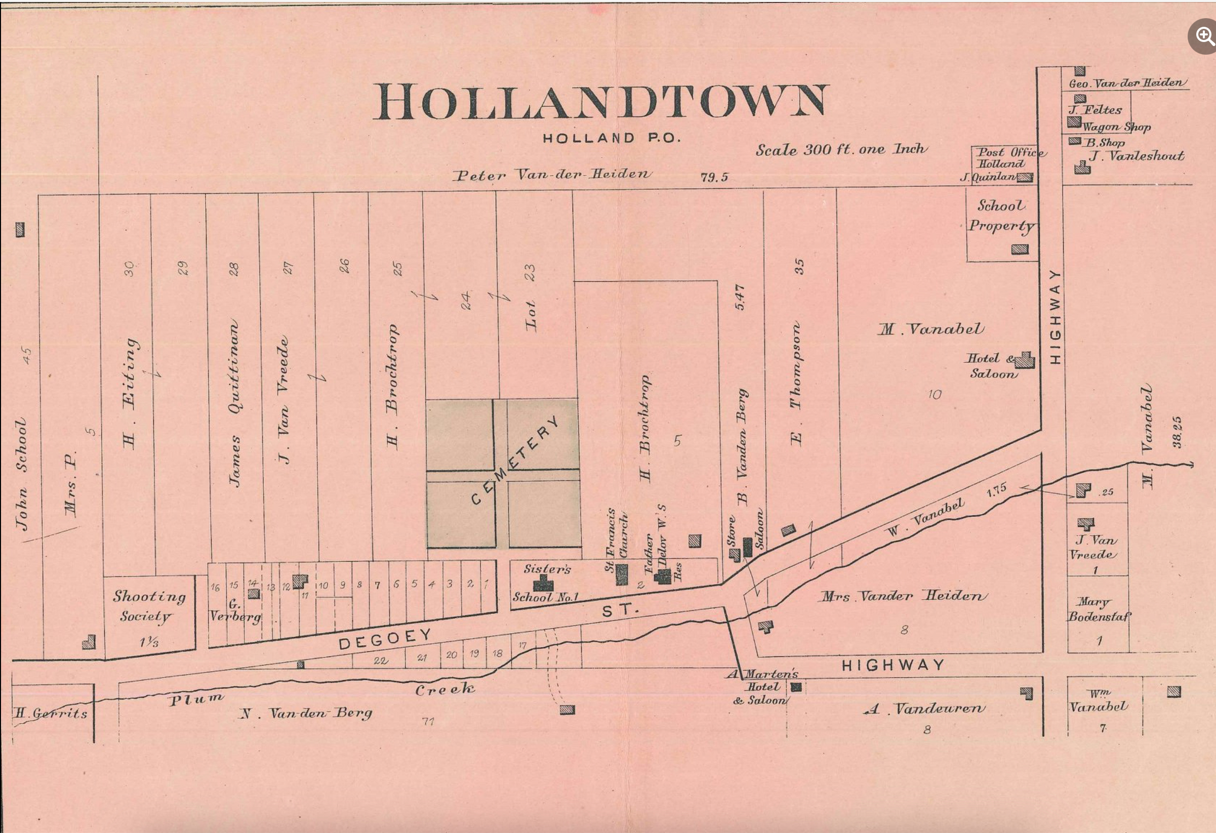
The next oldest map is from 1889 when Charles M. Foote published the “Plat Book of Brown County Wisconsin.”1 The full book including this amazing map detail found on pp. 38-39,2 is available on the UW Madison Libraries Search site: https://search.library.wisc.edu/digital/AVCDRPEN73HFJP83.
There is so much to see, including: THREE, count them, THREE saloons, two hotels, a general store, St. Francis church, rectory, and school. Plus a public school, and post office, and we can’t forget the Schut, or as it is labeled here, the “Shooting Society” property.
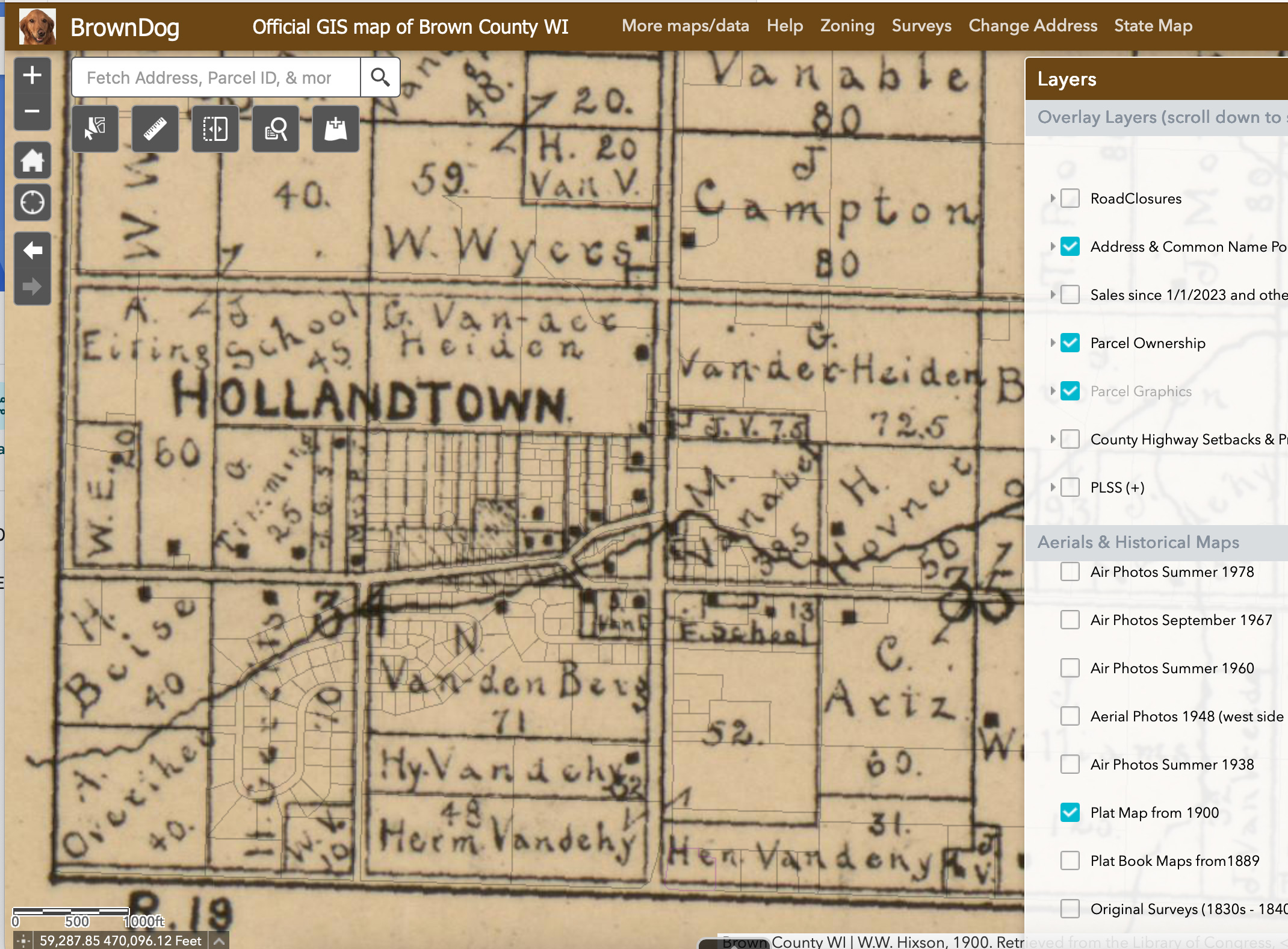
The map below is from 1900, and was published by W.W. Hixson & Co., and while a great image of the Town of Holland, does not zoom in enough to show any change that happened in Hollandtown proper.
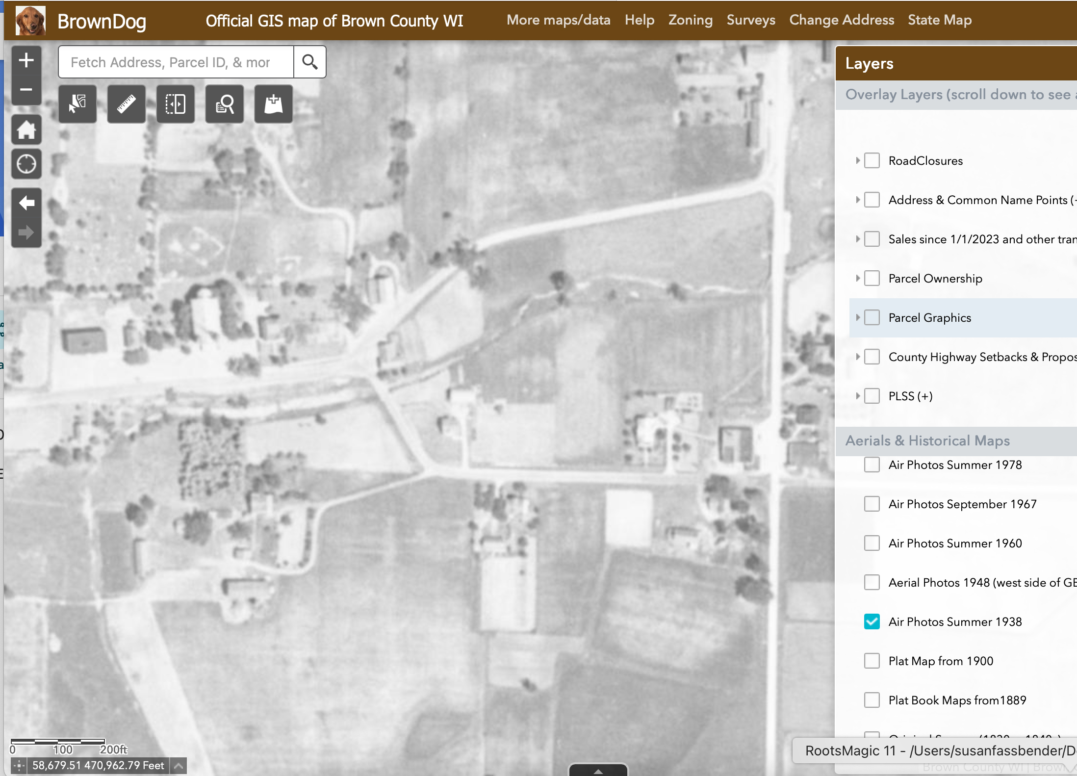
Next on the list from BrownDog are true gems, and include “Air Photos Summer 1938,” “Air Photos Summer 1960,” “Air Photos September 1967,” Air Photos Summer 1978,” etc. By clicking through 1938, 1960, 1967, 1978, 1990, 1992, 2000, 2005, 2010, 2014, 2017, 2020 and 2023 you can watch Hollandtown grow – right before your eyes.
BrownDog is an amazing resource. I invite you to check it out.
Now back to writing about the latest family memory.
SOURCES:
- Foote Charles M., and W. S. Brown, Surveyors and Draughtsmen, Plat Book of Brown County Wisconsin: Drawn from actual Surveys and the County Records (1889; reprint, Minneapolis, Minnesota: C. M. Foote & Co., 1889), pp. 46-47, Plat of Holland; digital images, University of Wisconsin-Madison, Libraries Search (https://digital.library.wisc.edu/1711.dl/VCDRPEN73HFJP83 : accessed 2 February 2020). ↩︎
- Foote Charles M., and W. S. Brown, Surveyors and Draughtsmen, Plat Book of Brown County Wisconsin: Drawn from actual Surveys and the County Records (1889; reprint, Minneapolis, Minnesota: C. M. Foote & Co., 1889), pp. 38-39, Plat of DePere, Holland, Duck Creek Station, Morrison; digital images, University of Wisconsin-Madison, Libraries Search (https://digital.library.wisc.edu/1711.dl/VCDRPEN73HFJP83 : accessed 2 February 2020). ↩︎
